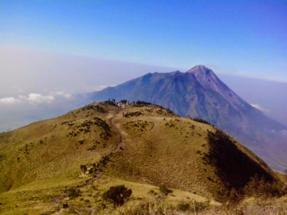
Merapai Mountain (2.965 mdpl), everyone is sure to know the mountain, this is the one of the volcano most aktive in the indonesia even in the world. Although  like that, this is one of the favorites spot to climbing.
http://images.travelpod.com/users/adventour/1.1269172497.merapi-volcano.jpg
 For climbing this mountain we can pass New Selo route. New selo route place in Boyolali regency.
located about 2 hours from the town of boyolali.
the ascent begins from base camp to post one,starts walk about 15 passes through the Township. after that we can find the writings of "NEW SELO" like in hollywod.


https://tersurat.files.wordpress.com/2014/08/selo-lulus-boyolali.jpg

after that the trip continue pass the forest, the road to post 1 is not difficult, we will pass a pretty shady forest.After nearly an hour of our trip came at the gate "Merapi and Merbabu-National Park", and then continued up the trail past the rimbunya forest in the Middle bottom of the merapi volcano to arrive in the post I (one). In this post there is a monument which is located on a ridge, about 1.5 meters in height. From the post I continued heading Pillar II, with steep and full of large rocks. the journey to this post takes about 1.5-2 hours. In this post, there is a monument, the same as in the previous post. from here we live takes about 1 hour to get to the "PASAR BUBRAH". Still climbing terrain is similar to the previous one. ahead of the market bubrah we will pass some memoriam who are on a plateau into the top of a ridge. from here you can just go down to the market Bubrah (scatter).


Pasar Bubrah is a stretch of rocks that reside in a valley. from here look a peak of 2. on the left is the path to the crater woro. And if a straight line is heading to the fore peak. From the bubrah to the top takes about 1 hour with the field through very steep and Sandy. Climbers usually practice the techniques of scrambling to get to the top, because the terrain facing the Rocky sand indeed easy avalanche.

We'd better be careful because high winds can come any time, as well as the danger of avalanches of rock that may be trampled by climbers above us. The ascent from Basecamp Selo (plalangan) to the top of Mount Merapi takes about 4-6 hours and the descent takes about 3-4 hours per street.


Yogyakarta one the places in recommended to spen your holiday. one of the must-see sights is glagah beach. The beach is located in Kulun Progo. the trevel to glagah beach from Yogyakarta take about 2 hours. 


This beautiful Glagah Beach has a superiority and its own uniqueness, including the existence of a lagoon that lies around the Glagah Beach and laguna is becoming attraction for visitors to enjoy the view of Glagah Beach by boat or paddle boat engines that have been provided by the tour manager Glagah Beach.
https://blogger.googleusercontent.com/img/b/R29vZ2xl/AVvXsEh2f96yPD-7-TXmWKk0jsIsEg6rltzsY7N9YkjSBh1TcCMtyPq2Y1wn0ViqqffcBJCxLeuC3_3UY8FUSHannRkczIY6acadL1HlxPJ9GHWlQnuWzWaTrj529-tNH2uMfTGS_RN3guaZrYj8/s1600/glagah.jpg


In addition the glagah beach there are also two long enough Pier, where the wecan enjoy blowing and the beauty of agin glagah Beach
the perfect time to visit glagah beach is inthe afternoon, because we can she a beautifull  sunset


http://natureones.com/wp-content/uploads/2014/11/merbabuu.jpg
Mount Merbabu is a Strato volcano type (see Volcanoes) located geographically on 7,5 ° s and 110,4 ° BT. administratively it lies in the Magelang Regency in West slope and Boyolali Regency in the East and South slopes, Salatiga and Semarang Regency in the North Slope, Central Java province .
Climb Mount Merbabu
  • Via Wekas Rote    
Baseecame climbing Mount mebabu located in Kenalan Vilages, Sub Pakis, Magelang .for memuju basecame climbers can hire motorcycle taxis with IDR 20,000. along the route to the basecame climberwill pass estate residents planted withvegetables typical of pegunungna such astobacco, carrots, cauliflower and broccoli.
 Bascame 
 For climbing Mount merbabu thatlicensing of IDR4000 plus IDR3000 forclimbers that carry motor. from allmountaineering mebabu not imposedquota system means the number ofmountaineers mebabu is not restrictedunless there are things like forest fires.to do regrestrasi do not require specialletters such as affidavits are healthy.
Basecame to Pos 2  
Start climbing the climbers will pass through the township residents withrocks arranged neatly. Once it gets pastfields planted with vegetables of manyresidents. setealah 30-minute climber willpass a cemetery on the left side of the road. After passing through the packedline to post 2, along the lines of heading2 climbers will pass pine forests. along the way climbers can also find waterpipes direct residents of mountainsprings. on the way heading 2 takes approximately 2 hours, but it will not bebecause along the way will find thescenery very beautiful pine forest.

Pos 2 to  te TOP

a journey from post 2 to the Summit is quite heavy, the road initially in skip quite flat. After walking 15 minutes we will rise to the top of a small hill which is pretty steep. After we pass the 2 hills we will find the path on the right left ravine, the climbers call it the "bridge of the devil". but it does need to be on the way because am is absolutely beautiful, the overgrown grass green savannas can make us forget will weigh the ascent. the journey continues down the cliff to the top is steep enough.

After about 2 hours we will get to the fork in the road each way to the 3 highest peaks of Mount merbabu. left turn is a way towards the peak of Sharif. on the way to the top of memekan Sharif took about 15 minutes. top Sharif is mount no. 3.
  turn right to the top of the highest peak is trianggulangsi peak travel, get tri angulangsi takes 20 minutes.

the highest peak in the us get the magnificent scenery can, selan can see savanna. from the top we can also see 5 other peaks, namely merapi, mount sindoro, cleft, lawu, and mountainous dieng.